AFRICA PROGRAMME 2004-2007First Training Programme for Natural World Heritage Sites in Africa |
 Â Â Â Â Â Â
 Â Â Â Â Â Â
 Â Â Â Â Â Â
 Â Â Â Â Â Â
 Â Â Â Â Â Â  |
|
Latest NDVI map available (period: 2006041-2006050)
Image courtesy of FEWS Net Use the tool bar for zooming in or out the map. Mouse over for description of the alert and click for more information on the alerts. |
Legend :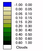 |
|
The Normalized Difference Vegetation Index (NDVI) provides a measure of the amount and vigor of vegetation at the land surface. The magnitude of NDVI is related to the level of photosynthetic activity in the observed vegetation. In general, higher values of NDVI indicate greater vigor and amounts of vegetation. NDVI is derived from data collected by National Oceanic and Atmospheric Administration (NOAA) satellites, and processed by the Global Inventory Monitoring and Modeling Studies (GIMMS) at the National Aeronautics and Space Administration (NASA). NDVI imagery is calculated from the red and near infra-red reflectances observed by the AVHRR (Advanced Very High Resolution Radiometer) sensor on NOAA meteorological satellites. The NDVI image provides an indication of the vigor and density of vegetation at the surface. Images of NDVI are sometimes referred to as "greenness maps" since they represent the vegetative vigor of plants. | |